To solve the world’s biggest environmental challenges, first, you need the tools to understand them.
The University of British Columbia’s Master of Geomatics for Environmental Management (MGEM) is an accelerated, 9-month, professional master’s degree program that provides essential training in the use and application of geospatial tools used to plan, develop, manage, and evaluate programs to protect and regulate natural habitats and renewable natural resources.
Why Choose the MGEM Program?
The use of geospatial data, tools, and technologies is crucial for making informed decisions that impact environmental management. This interdisciplinary degree blends landscape ecology training and quantitative spatial skills development to prepare graduates to tackle pressing environmental issues across multiple sectors.
Get hands-on experience.
Apply geospatial data to real-world challenges in environmental management through labs, projects, and workshops.
Expand your professional toolkit.
Gain expertise in geomatics technologies, methods, and tools grounded in emerging landscape ecology theories and principles.
Learn from the best in the field.
Courses are taught by our world-class faculty, including courses that integrate professional communication and diverse knowledge systems. Students also gain opportunities to meet and be mentored by working professionals.
Connect with people from around the world.
As a globally acclaimed faculty, we proudly welcome students from over 40 countries annually. The MGEM program reflects this diversity, attracting individuals world-wide.
What Will you Learn?
This 9-month professional master’s program combines a mix of theory and hands-on learning, beginning with a week-long program launch which includes an orientation and weekend retreat.
- A Landscape Ecology and Management course focuses on landscape quantification modeling and environmental management
- Analytical and quantitative courses in GIS, remote sensing, image processing, spatial statistics, spatial data analysis, and programming such as R and Python
- Sector-focused project management training
As an MGEM graduate, you will be equipped to:
- Model landscapes and ecosystems for planning and assessment
- Integrate geospatial, ecological management theories with geomatics tools and programing to tackle real-world issues
- Use geospatial data to address environmental concerns
- Work in a variety of sectors – including academia, consulting, industry, government, NGOs, and the private sector

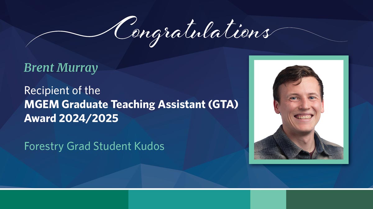
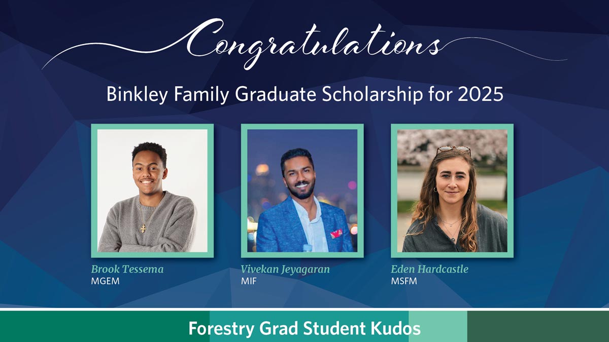
Brook Tessema
2025 MGEM Binkely Family Graduate Scholarship Winner
My time in the MGEM program was an unforgettable and formative experience. I really enjoyed learning alongside like-minded classmates and building my coding and spatial analysis skills from the ground up. Collaborating with peers to solve problems made the experience both challenging and rewarding. I’m especially grateful to the instructors and TAs, who were not only generous with their time and technical guidance, but also offered valuable career advice and mentorship throughout the program. A highlight was my capstone project, where I worked with conservation organizations to monitor mangrove forest recovery contributing to practical research with real-world impact. My time at MGEM was truly invaluable.

Darcy Turin
MGEM 2025 student
The MGEM program provided a strong foundation in spatial analysis and remote sensing, supported by an academic team strongly committed to student success. I appreciated the program’s balance of theory and real-world application through labs and the capstone project. Not only did we cover a diverse breadth of topics, but the intensive nature of the program also strengthened our time management and problem-solving skills. The cohort brought together people from diverse academic and professional backgrounds and met each of us where we were, creating a dynamic learning environment where everyone could thrive.

Johic Olivier Mes
MGEM 2025 student
MGEM was an academic breath of fresh air. The dedicated classroom, cohort size, and engaged professors immediately immersed me in a collaborative and passionate environment that supercharged my learning. The program covered a wide range of relevant concepts, from GIS software and programming to wider ecology concepts and diverse knowledge systems. Through the various projects, I developed a set of skills that makes me feel confident and prepared for entering the field of geomatics. Beyond academics, MGEM allowed me to meet a wonderful group of friends that truly made the program special.

Gwyn Taylor
Aquatic Research Biologist
Fisheries and Oceans Canada
The Master of Geomatics for Environmental Management (MGEM) program provided me with the tools and technical skills to advance my career in the fields of geomatics and ecology. The coursework built on my coding and GIS skills from the basics to complex geospatial analyses used to tackle real-world problems in environmental management. I learned to work with valuable tools such as LiDAR, R, Python, and drones. The 599 capstone project provided a great opportunity to implement the skills gained, from initial research proposal to presenting my final results to the client.

Aster Chen
Attending the Master of Geomatics for Environmental Management (MGEM) program was definitely a wonderful journey in my studying life. The teaching team provided strong support during the 9-month session, cultivating my capability for advanced geospatial analysis with ArcGIS and programming using R/Python. The capstone project helped me develop research skills and introduced me to hands-on remote sensing techniques. This program has equipped me with solid technical skills required for the geomatics field nowadays, as well as various soft skills including project management and policy analysis which are assets for my future career. Most importantly, I encountered a group of incredible people through this program and I truly appreciate their intelligence and dedication.